top of page


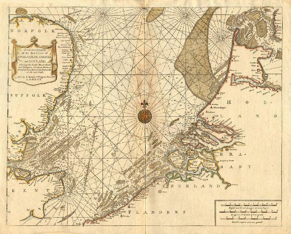
A correct chart of the sea coasts of England Flanders and Holland, by
Mount and Page, 1771
Mount and Page
Maker:
Collectie:
NavigArte
The nautical map shows the southern part of the North Sea with the adjacent coasts of England, Holland and Flanders.
1/1
This fabulous nautical chart shows the southern part of the North Sea with the adjacent coasts of England (including much of Kent, Essex, Suffolk and Norfolk), Holland and Flanders (Belgium and the Pas de Calais). Offshore features, notably depths and sandbanks are marked, include the Broad Fourteens. Many coastal towns and villages are named.
bottom of page