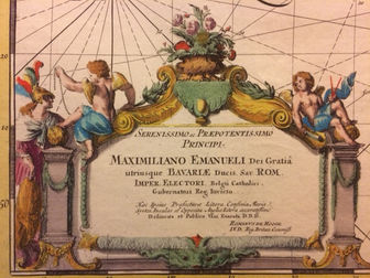
Carte Nouvelle des Costes de Hollande, Zeelande, Flandre, Picardie, & Normandie
Beautiful seamap of Flanders and Zeeland by Romeyn de Hooghe for Covens & Mortier 1721-41
Type of object:
Maps and globes
Time period:
Gouden eeuw Nederland
Place:
Amsterdam
Date:
1741
Maker / Author:
By Romeyn de Hooghe
Publisher / Printer:
Covens & Mortier
Dimensions:
94.5 x 59 cm
Material:
large map copperprint and original coloring
Graduation:
Inscription:
Provenance:
Composite Atlas. Amsterdam, Covens & Mortier
References:
van Egmond, Covens & Mortier, p.323, 1.3; Campbell, Early Maps, p.96-67, pl.44

Description
Seachart of Flanders, Zeeland and the Channel, engraved by Romain de Hooghe. Two insets: the port of Calais and the port and city of Dunkerque. Romeyn de Hooghe, a celebrated artist from the late seventeenth century, was responsible for a volume of nine sea charts. When found in full colouring characteristic of their time, they are among the most magnificent of their time. From composite Atlas. Amsterdam, Covens & Mortier, 1720-41
Additional information


