top of page

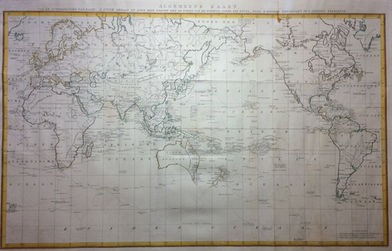
Algemene Kaart van de ontdekkingen van Kapit. J. Cook gedaan op zyne drie togten
Type of object:
Maps and globes
Time period:
Britain rules the waves + France
Place:
Netherlands
Date:
1797
Maker / Author:
C. van Baarsel
Publisher / Printer:
C. van Baarsel
Dimensions:
55 x 87 cm
Material:
thick paper copper engraving, probably later hand colouring
Graduation:
Inscription:
Provenance:
References:

Description
A very large world map with James Cook's sailing routes, from the Dutch edition of the third voyage of kapt. Cook
Additional information
bottom of page


